The Occitaine Tutorial
This tutorial guides users through the process of running an energy assessment for a ground-mount single-axis tracker PV project when a layout has already been developed and modified in external CAD software. In this tutorial, a site is created using land and trackers layout exported from CAD software into geolocated files (e.g., Google Earth KMZ files or ESRI Shapefiles). Further, it illustrates how to automatically string inverters using inverter blocks defined in external ESRI shapefiles.
This is a fictitious site located in Occitaine, France.
Objective
By the end of this tutorial new users will be able to do the following:
- Locate site
- Download background and terrain map layers
- Calculate horizon
- Import climate data
- Set albedo
- Import module and inverter files
- Define tracker system properties
- Import parcel (land plot) data
- Import tracker locations from external files
- Assigning the strings to inverters from external files
- Run 2D shading and energy calculation on the cloud
- Review and export the results
Note
Visit SolarFarmer's portal page (https://myworkspace.dnv.com/knowledge-centre/solarfarmer/) and go to the 'Downloads > Demo Data' page to download the files to use for this tutorial.
This tutorial was written for SolarFarmer 1.3. If you are using a later version you may see style and features variations from the screenshots shown below.
Introduction
Open SolarFarmer to start a new project.
 Setup site
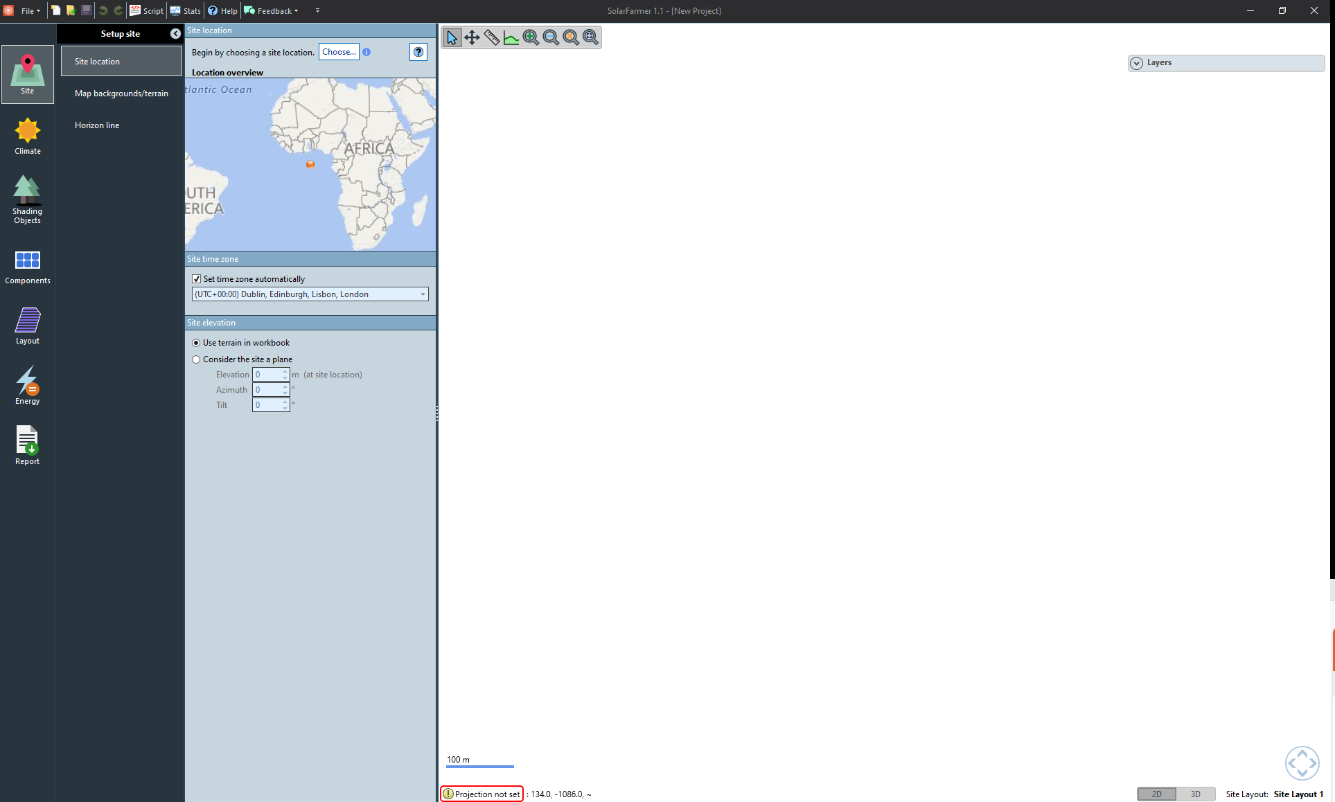
Define site location
The first page you'll see is the Site location page.
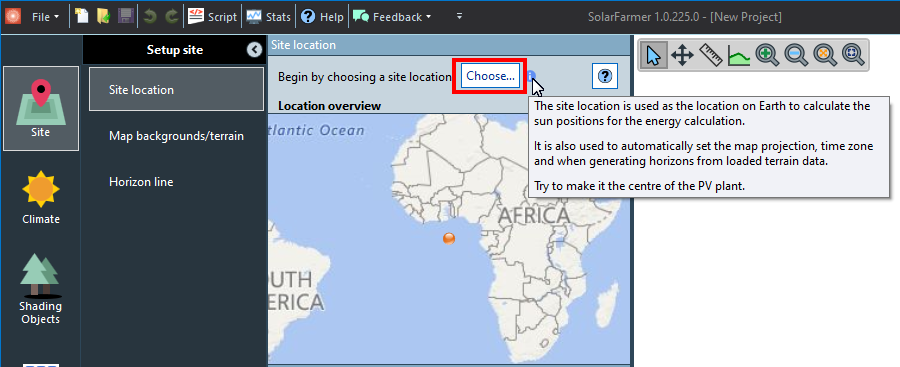
Click the Choose… button to open the location wizard (see image below).
Note
It takes a second for location wizard to come up, and requires an internet connection.
Once the location wizard opens, you need to set a location. There are two ways you can do this:
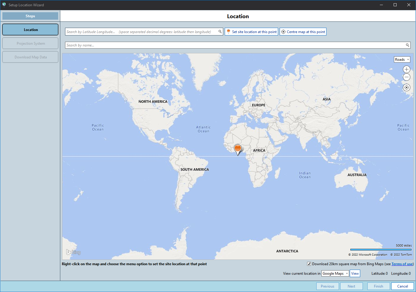
Search by latitude and longitude
Copy and paste44.191125 1.638790and then click Set site location at this point.
Note
You can also search by place name.
Zoom and pan the map to find the site's location, and make sure to right-click on the map on the site's location and choose 'Set the site location here' to set the actual site location.
Once you've set the location, click Next to move to the next step in the wizard.
Set the Projection System. The recommended projection system should be UTM Zone 31 Northern Hemisphere, WGS84 datum.
Note
It's recommended to use the default Projection System settings.
Nevertheless, when importing parcels and trackers data from external files (*.shp or *.kml) it is important that the files are either in latitude/longitude coordinates or in an equivalent projection in metric units.
In SolarFarmer, you can navigate across the projection systems and datums, or projection systems can also be found by their EPSG code.
Click Next and wait for the Roads map imagery to download.
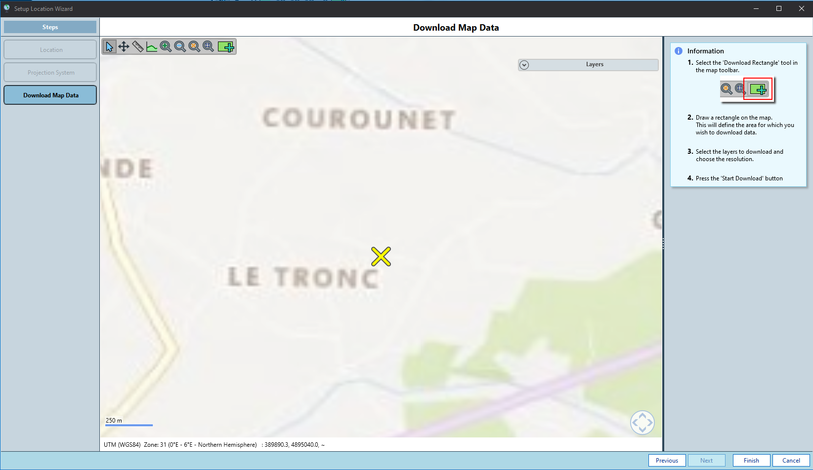
Once downloading has finished, use the rectangle selection tool
 on the toolbar to select
an area approximately 1.5km x 1km around the site for which you want to download
detailed map imagery data. Check the options SRTM terrain low res (3 arc-sec) and Aerial imagery.
on the toolbar to select
an area approximately 1.5km x 1km around the site for which you want to download
detailed map imagery data. Check the options SRTM terrain low res (3 arc-sec) and Aerial imagery.Click the
 button (you can download more data later if needed).
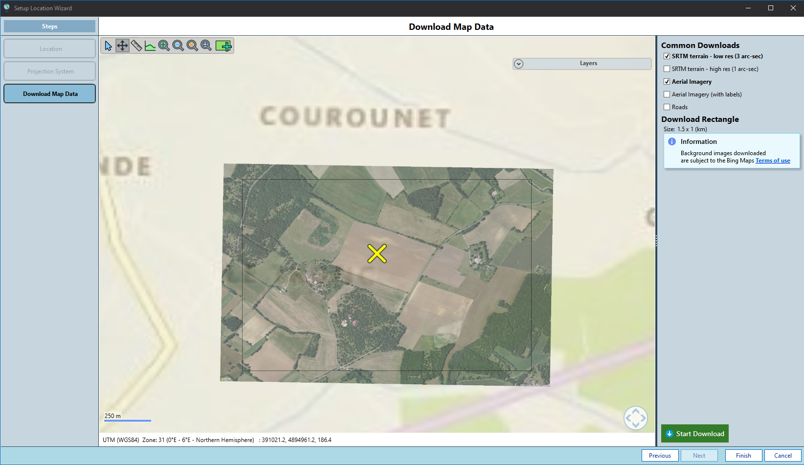
Click Finish to end the wizard and return to site location page.
View Map background / terrain data
On the Map backgrounds/terrain page you can see the files that have been downloaded. The user guide offers a full explanation for Working with the Map, including map tools, layer management and 3D navigation.
Use the Working with the Map guidance to explore the gradient of the site by:
- Identifying slopes indicated by the slope magnitude map layer
- Using the elevation profile tool
 to take slices of the terrain
 Switching to 3D Mode
 and viewing the site from different viewpoints and angles
Note
You can import more background / terrain data in the Map Backgrounds and Terrain task if you need to.
Define Horizon line
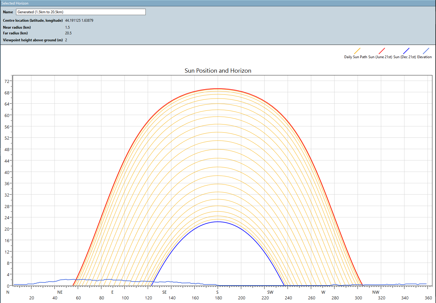
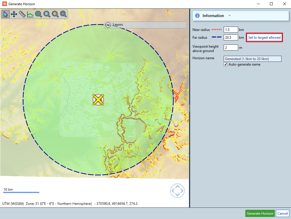
Go to the Horizon line page and click the Generate… button.
Click the Generate horizon button.
Select to 'Set to largest allowed' for the far radius if the terrain tiles do not reach the default 30 km far radius.
Note
You can edit, import, or export horizon data. Consult the Horizon Line page for more details on this topic.
 Define climate and solar resource
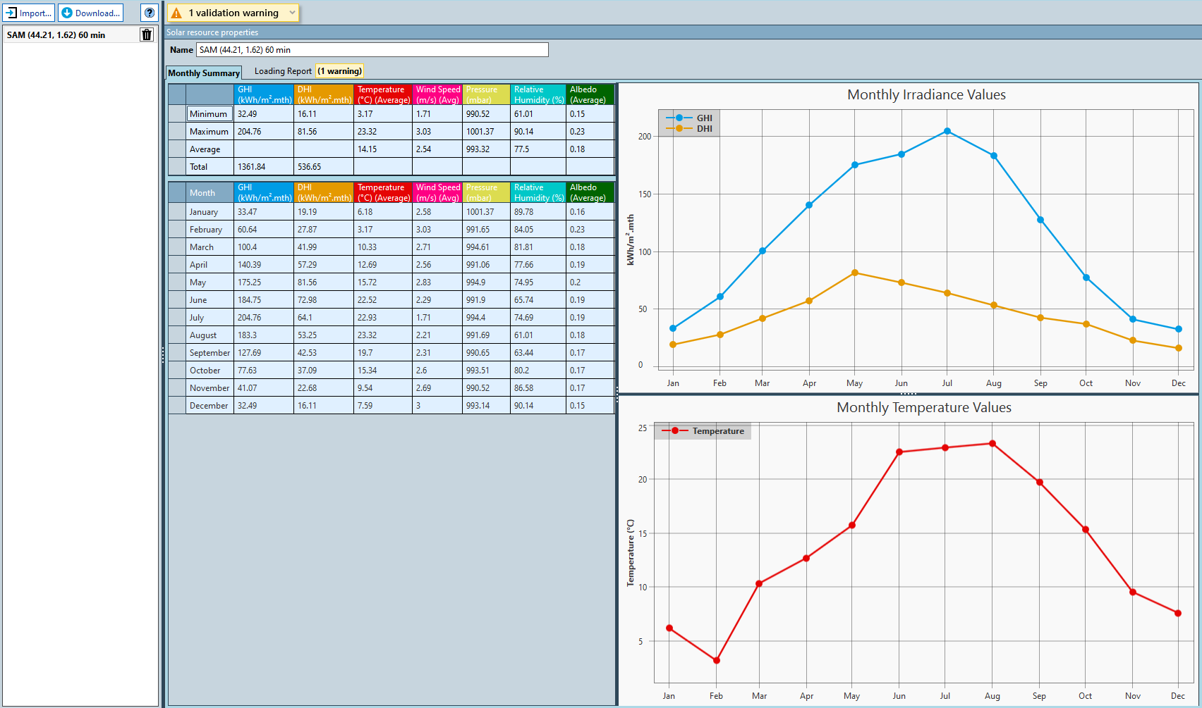
In this tutorial, we will use a Typical Meteorological Year (TMY) from the NREL's National Solar Radiation Data Base (NSRDB) with local timestamps (UTC+1), which is provided with the tutorial data.
Define solar resource
Go to the Solar resource page.
Import the solar resource:
Click the Import… button, choose as solar data type "NREL SAM (*.csv)", select the resource file
"SolarResource/404081_44.21_1.62_tmy-2022.csv"from the data folder that you downloaded at the start of this tutorial. Then click the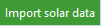 button.
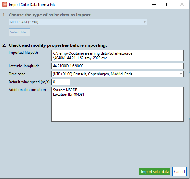
You can view any warnings in the Loading report tab and the monthly statistics in the Monthly summary tab (see screenshot below). There is a warning for a DHI value as shown below:
You should have the solar resource data defined.
Define albedo
The NREL NSRDB TMY has albedo data and SolarFarmer will use the hourly albedo for the energy calculation. However, we can define the Annual Albedo Value as 0.18, which is the average albedo reported by the resource data and will be used in case of any missing data value in the timeseries.
Note
More information can be found in the Albedo page.
Links to relevant sections of the user guide are indicated by the  symbol in the user interface.
 Define shading obstacles
This project is far enough from buildings to ignore near shading objects. Continue straight to the next chapter.
 Define components
PV Modules
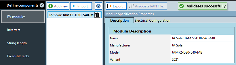
Click the Import button and select PV module PAN file "PAN/JA_Solar_JAM72_D30_540_MB.PAN" from the
data folder that you downloaded at the start of this tutorial. You'll now see the PV module properties. The module is a bifacial module with half-cell modules.
Inverters
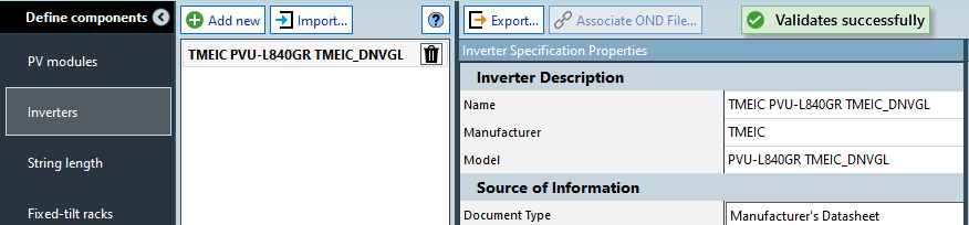
Click the Import button and select the Inverter OND file "OND/TMEIC_PVU-L840GR_DNVGL.OND".
In the inverter properties at the bottom right you will notice that this inverter has 1 input.
String Length
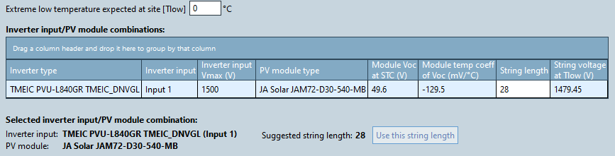
Leave the Extreme low temperature set at 0°C.
Ensure 28 is entered for the String length (modules per string), see screenshot below:
Define Trackers
Skip the Fixed-tilt racks task and go directly to Trackers. Click the Add new
 button to create a new Tracker.
Rename the tracker system to
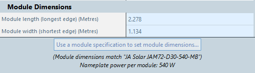
Tracker JA 2PModule dimensions should be automatically match the imported JA Solar PV module, (if not click Use module specification… button)
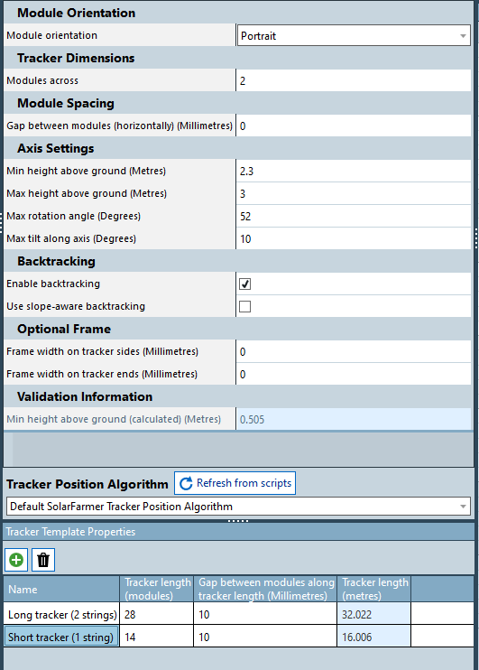
Define the tracker properties:
- Select
Portraitas module orientation, and 2 modules across (configuration 2P). - Type a minimum height above ground of 2.3 metres and maximum rotation angle of 52 degrees.
- Tick the box to
Enable backtracking.
- Select
In the Tracker Template Properties section, add two new templates (green plus icon).
Set the Length of tracker row to 28 modules and 14 modules with 10 millimetres gap between modules along tracker length. You can rename the tracker templates as "Long tracker (2 strings)" and "Short tracker (1 string)" to better identify them.
Inverter Blocks
Skip the inverter blocks page for this tutorial. These are used to save time in very large layouts by repeating a common pattern.
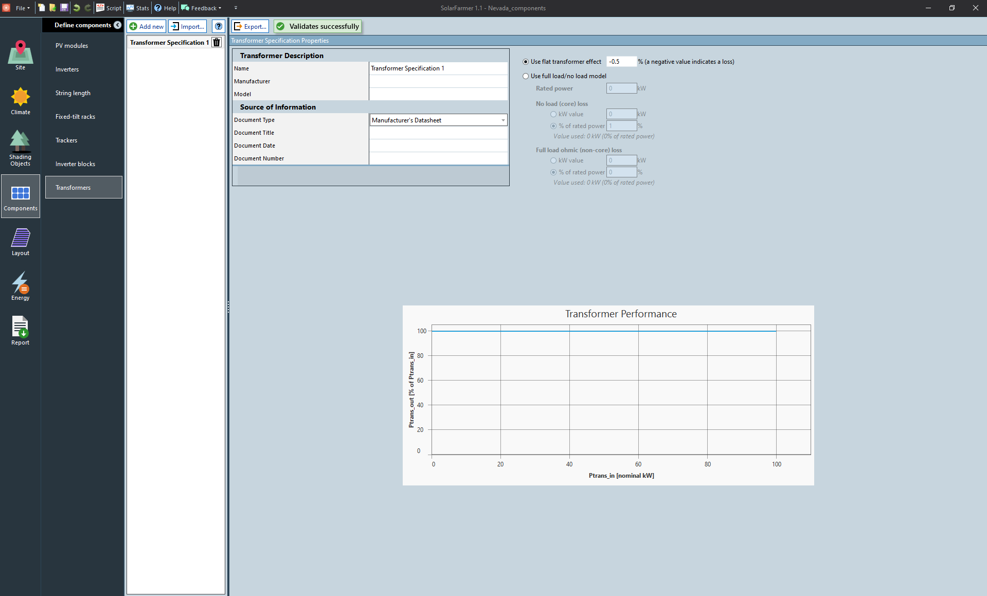
Transformers
Click the Add new
 button to
create a new Transformer.
button to
create a new Transformer.Set a flat transformer effect for a constant loss as -0.5%
 Layout
Layout importing
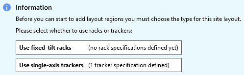
Select the option Use single-axis trackers to start
To define the layout, we will use the Site Layout Import… functionality.
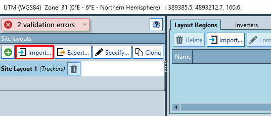
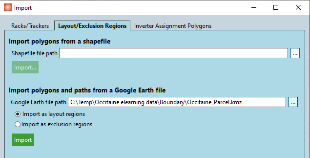
First we will import the parcel (land plot). In the Import dialog, go to the Layout/Exclusion Regions tab.
- In the Google Earth file import section, choose the Google Earth KMZ
"Boundary/Occitaine_Parcel.kmz"from the file that you downloaded at the start of this tutorial and click the Import button.
- In the Google Earth file import section, choose the Google Earth KMZ
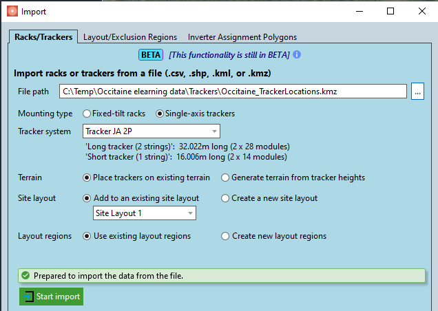
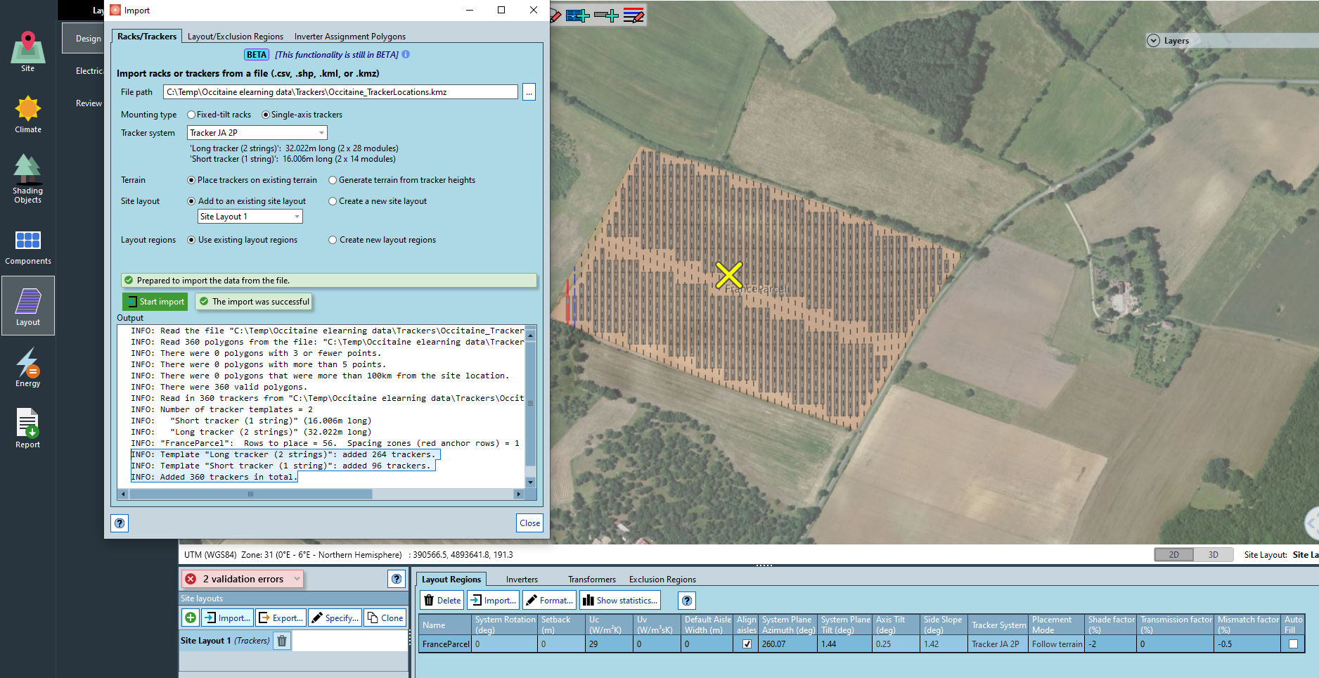
We then follow with the tracker locations. In the Import dialog, go to the Racks/Trackers tab.
Choose the Google Earth KMZ
"Trackers/Occitaine_TrackerLocations.kmz"from the file that you downloaded at the start of this tutorial.Choose the tracker system
Tracker JA 2P(the two tracker templates will be displayed).Select "Place trackers on existing terrain" for the terrain.
Select "Site Layout 1" and "Use existing layout regions".
Click the Start import
 button to initiate the trackers import from the external file.
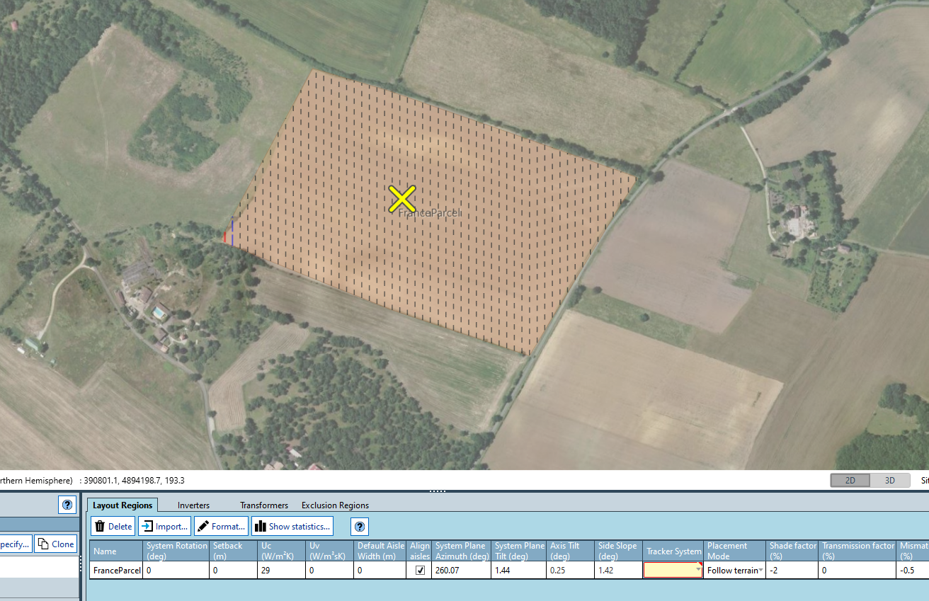
You will see that the import dialog outputs some information lines about the polygons found in the file (360 polygons), where all of them were valid. There are also details about the specific number of trackers templates added to the site. The trackers will be displayed in the layout.
Note
The import of the layout takes a few seconds. For large +100MW sites with thousands of trackers it can take up to 20-30 seconds.
This tutorial represents a small example and it takes less than a second to complete the import.
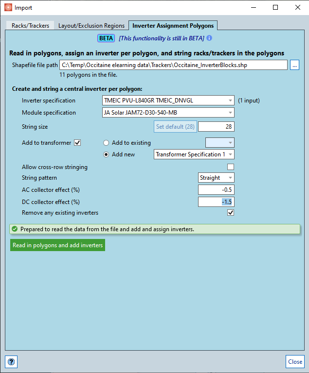
Stringing of modules to inverters
SolarFarmer allows you to string the trackers/racks to inverters manually, automatically using the specify site tool, a tool to quickly set design constraints and generate layout variations or by defining inverter blocks from external files.
For this tutorial, we will use the method of assigning inverters from polygons in an external file.
In the Import dialog, go to the Inverter Assignment Polygons tab.
Choose the Shapefile
"Trackers/Occitaine_InverterBlocks.shp"from the file that you downloaded at the start of this tutorial.Once you select the file, the number of polygons in the file will be shown just under the file path box. In this case, there are 11 polygons in the file.
Each polygon represents a single inverter. Select the specific inverter, module and string size.
You can choose to add a transformer.
Define the losses for the AC cabling as -0.5% and DC cabling as -1.5%.
Click the Read in polygons and add inverters
 button to initiate the automated inverter assignment.
 You will see informative outputs in the dialog. Close the dialog once finished.
The trackers will have been assigned to the different inverters based on the polygons in the external file. The resulting layout would be as shown below:
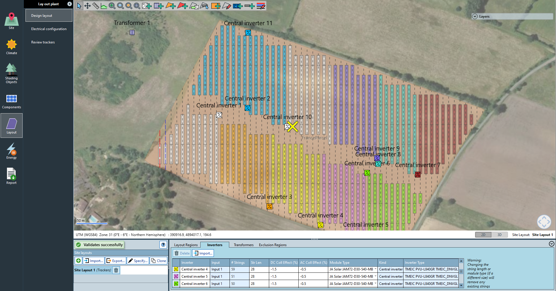
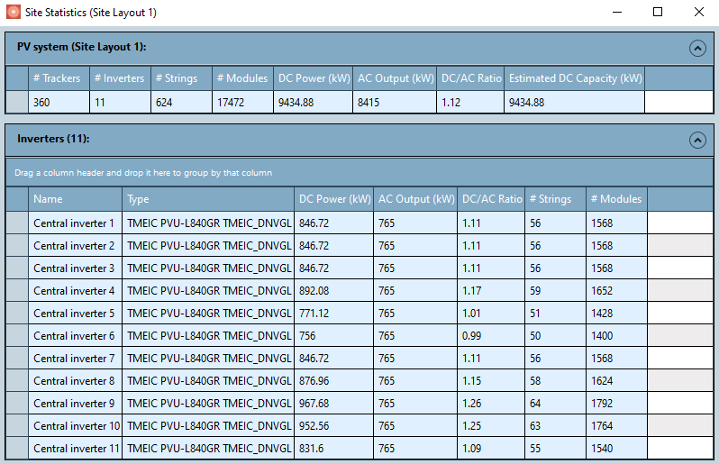
You can visualise the loading of the inverters in the Stats tab in the main tool bar.

In this case, there are different DC/AC ratio in some of the inverters (from 0.99 to 1.26). This is a representation of the different changes that could occur as the engineering stages of the project evolve to adapt to certain design constraints.
 Energy
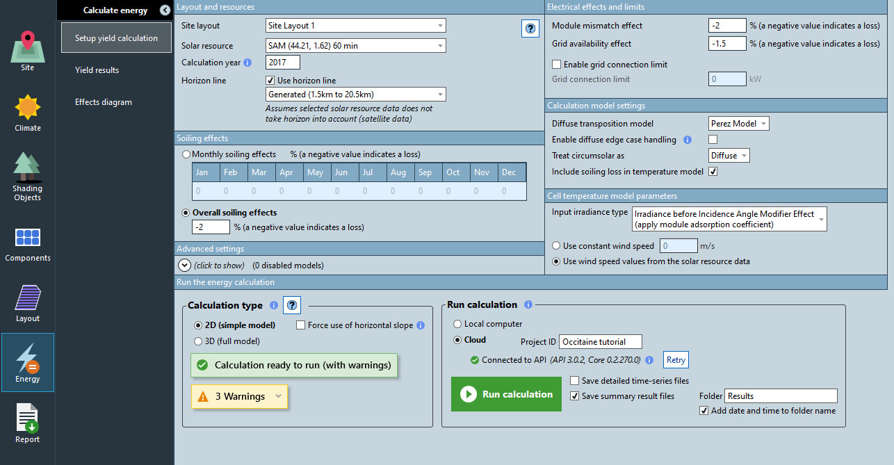
Setup yield calculation
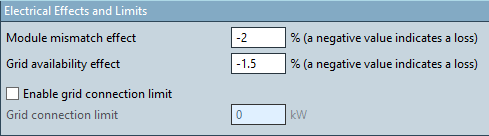
Set the Module mismatch effect to -2.0% (see image below)
Set the Grid availability to -1.5% (see image below)
Set an overall soiling effect to -2.0% (see image below)

Save the workbook by clicking File > Save as and give it a name, e.g.,
"Occitaine Tutorial".Note
You need to save the workbook before running a simulation.
Select 2D (simple model) OR 3D (full model) for the Calculation type option.
Select Cloud for the Run calculation option. You will need to have your SolarFarmer API token (see Acquiring your Web API Token) and had already define it as an environment variable (see Running calculations in the cloud from SolarFarmer).
Note
If you did not have the SolarFarmer API token defined as an environment variable, you will need to close and reopen the SolarFarmer workbook.
If that's the case, save the workbook not to lose your progress.
The 3D API calculation is still under private preview. See further details in SolarFarmer Web API.
To speed up calculation time, uncheck the box Save detailed time-series files and check the box Save summary result files.
Click the Run calculation button to start running the calculation.
- The 2D cloud calculation should take around 10-15 seconds. The 3D cloud calculation will take longer (around 6-9 minutes) depending on the servers availability.
Note
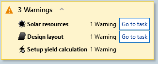
You will see some warnings. You need to expand the warnings panel and hover over each one to read the description.
Warnings point out possible areas that need checking but do not stop you running a calculation.
In this example are informative and you can ignore the warnings.
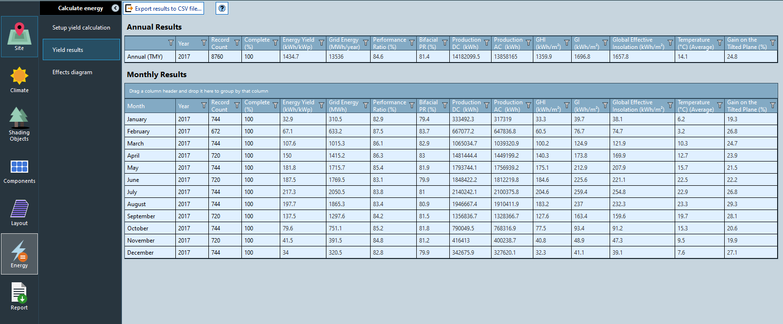
View Yield summary
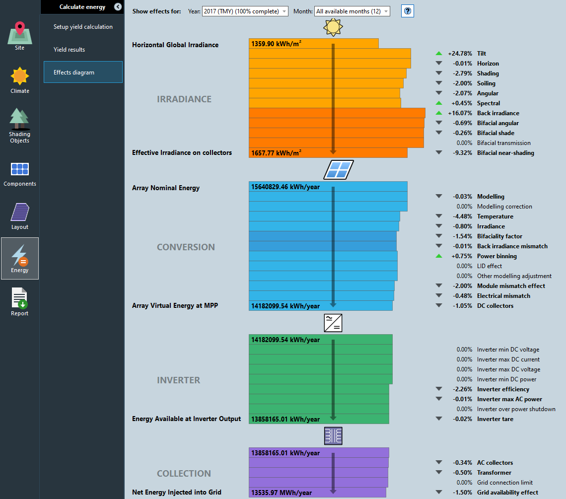
View Effects diagram (loss tree)
Generating a report
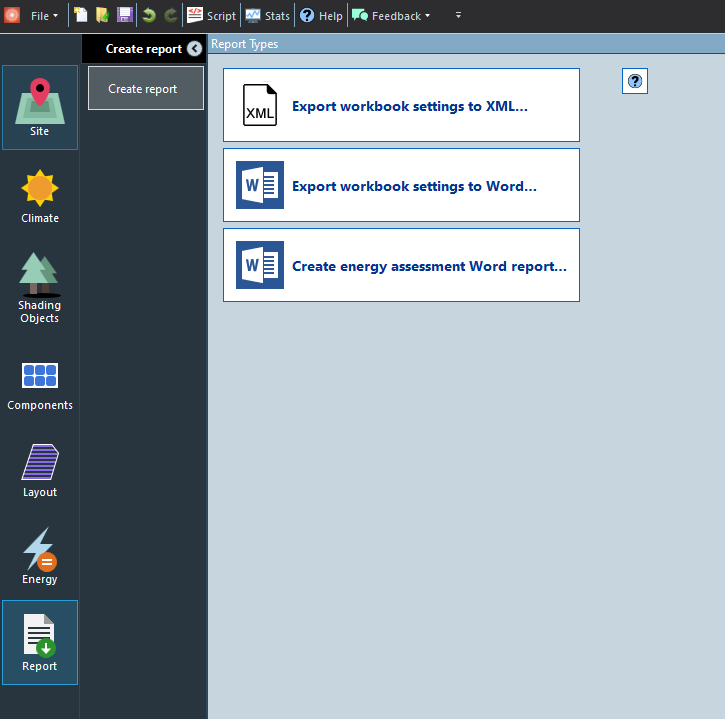
In the Report chapter, click the 'Create Energy Assessment Report...' button.
This creates a Word document (using a built-in template) of all the workbook settings and the energy yield calculation results (tables and effects diagram).
You have now completed the Occitaine detailed design tutorial using external files.
End of the tutorial.