Albedo
Albedo is a measure of the reflectivity of a surface, in this case the ground around the PV plant under analysis. A value of 1.0 indicates perfect reflectivity. A value of 0 indicates complete absorption.
Typical values range from 0.15 for grass to 0.8 for fresh snow. Indicative reference values available in the scientific literature are provided below for several surface types:
| Type of surface | Typical albedo range |
|---|---|
| Asphalt | 0.07 - 0.10 |
| Gravel | 0.12 - 0.22 |
| Concrete | 0.17 - 0.31 |
| Sand | 0.15 - 0.45 |
| Bare soil (fields) | 0.12 - 0.25 |
| Grass (green) | 0.15 - 0.27 |
| Tundra | 0.18 - 0.25 |
| Desert sand | 0.30 - 0.40 |
| Snow (old/melting) | 0.40 - 0.80 |
| Snow (fresh) | 0.80 - 0.90 |
In SolarFarmer, you can specify albedo as either a single annual value or 12 monthly values (if your site has a strong seasonal variation).
In addition, you can provide albedo data for each timestamp of your solar resource data using:
- a
*.tsvfile (column header Albedo) - a 'PVsyst standard format' file (column header AlbedoDaily)
- a Solcast CSV file (column header albedo)
Note
Albedo provided as part of the solar resource file will only be used for cloud-based calculations.
You still need to provide a monthly or annual value that will be used as a fall-back value in case
there is any missing data in the albedo timeseries.
When using albedo data as part of the solar resource data, albedo will appear in the summary table together with other meteorological variables as shown below:
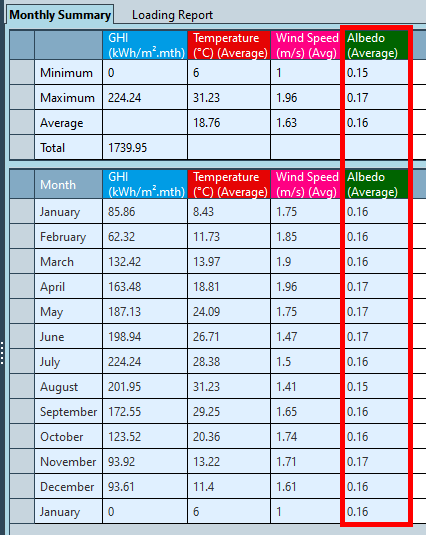
The monthly albedo values are averaged albedo weighted for radiation income, which are estimated considering the provided global horizontal irradiance (GHI) and surface albedo data.